

A low-pressure zone with cyclonic potential from the Lesser Antilles is advancing towards the western Caribbean. It’s nearing the coasts of Belize and Quintana Roo. The system has been moving over the central part of the Caribbean and is now about 865 km southeast of Quintana Roo’s coast, progressing westward at a swift speed of 32 km/h.
The disturbance currently has a low potential for developing into a cyclone, with only a 10% chance predicted within the next 48 hours and a 30% chance within the next week. Despite these low odds, the US National Hurricane Center hasn’t ruled out the possibility of this system developing into a cyclone over the northwestern Caribbean or southwestern Gulf of Mexico in the coming days.
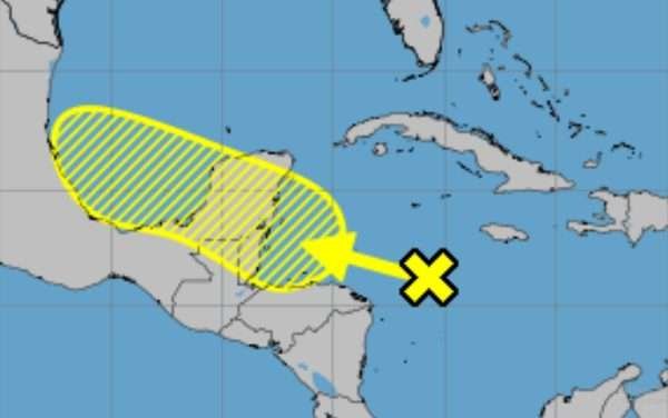
The Quintana Roo State Civil Protection Coordination (Coeproc) is preparing for the low-pressure area to cause heavy to extreme rainfall over the weekend. The southern and central areas of Quintana Roo are expected to be particularly affected. These weather conditions are forecasted to start on Thursday and continue into Friday, when the system is expected to move towards the Gulf of Mexico.
The National Meteorological Service (SMN) is also closely monitoring a separate low-pressure area associated with a tropical wave over the Atlantic. This system has a 40% chance of developing into a cyclone within 48 hours and a 70% chance within the next week.
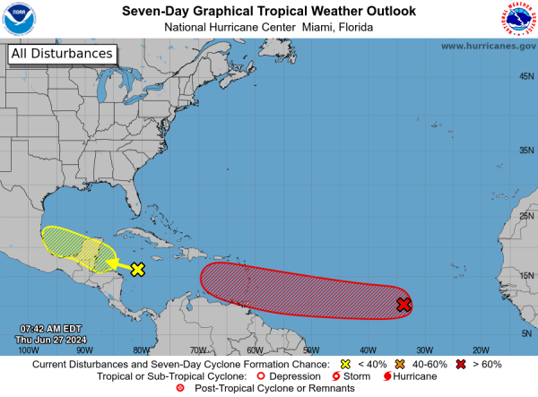
Currently located about 5,865 km east of Quintana Roo’s coast, this system is moving westward at a variable speed between 24 and 32 km/h. Although it currently poses no risk to Quintana Roo’s coast, monitoring will continue due to its trajectory, which is pointing towards the Lesser Antilles and the Caribbean Sea.
Discover more from Riviera Maya News & Events
Subscribe to get the latest posts sent to your email.